Mahakali Zone (Mahākālī Zone)
In 2015 Nepal discontinued use of zone designations in favor of provinces. The zone formerly known as Mahakali is now part of Sudurpashchim Province.
Mahakali's headquarters is Bhimdatta (formerly called Mahendranagar) in Kanchanpur District. The zone covers the Himalayan range including Api Peak in the North, Hill valleys, Inner Terai valleys such as Patan Municipality in Baitadi District in the center and the outer Terai in the South. The name of this zone is derived from the Kali River.
The boundary of this region was Kali river on the west and Seti Zone on the east. After the Sugauli Treaty (also spelled Segowlee) was signed on December 2, 1815 and ratified on March 4, 1816, between the British East India Company and The Kingdom of Nepal; Kali river which originates from Limpiyadhura, became the international boundary with the United Provinces of British India (now Uttarakhand, India). The coldest area in the zone is Byash and the hottest is Kanchanpur. The Api Himalayas lie in this zone from where Chameliya river originates.
Map - Mahakali Zone (Mahākālī Zone)
Map


Country - Nepal
 |
 |
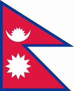
| Flag of Nepal | |
The name "Nepal" is first recorded in texts from the Vedic period of the Indian subcontinent, the era in ancient Nepal when Hinduism was founded, the predominant religion of the country. In the middle of the first millennium BC, Gautama Buddha, the founder of Buddhism, was born in Lumbini in southern Nepal. Parts of northern Nepal were intertwined with the culture of Tibet. The centrally located Kathmandu Valley is intertwined with the culture of Indo-Aryans, and was the seat of the prosperous Newar confederacy known as Nepal Mandala. The Himalayan branch of the ancient Silk Road was dominated by the valley's traders. The cosmopolitan region developed distinct traditional art and architecture. By the 18th century, the Gorkha Kingdom achieved the unification of Nepal. The Shah dynasty established the Kingdom of Nepal and later formed an alliance with the British Empire, under its Rana dynasty of premiers. The country was never colonised but served as a buffer state between Imperial China and British India. Parliamentary democracy was introduced in 1951 but was twice suspended by Nepalese monarchs, in 1960 and 2005. The Nepalese Civil War in the 1990s and early 2000s resulted in the establishment of a secular republic in 2008, ending the world's last Hindu monarchy.
Currency / Language
| ISO | Currency | Symbol | Significant figures |
|---|---|---|---|
| NPR | Nepalese rupee | ₨ | 2 |
| ISO | Language |
|---|---|
| EN | English language |
| NE | Nepali language |